{"p":"","h":{"iv":"ROXSYW+cfvEbFHu5","at":"ocxplSQjdRC3tXEtB/9/wg=="}}

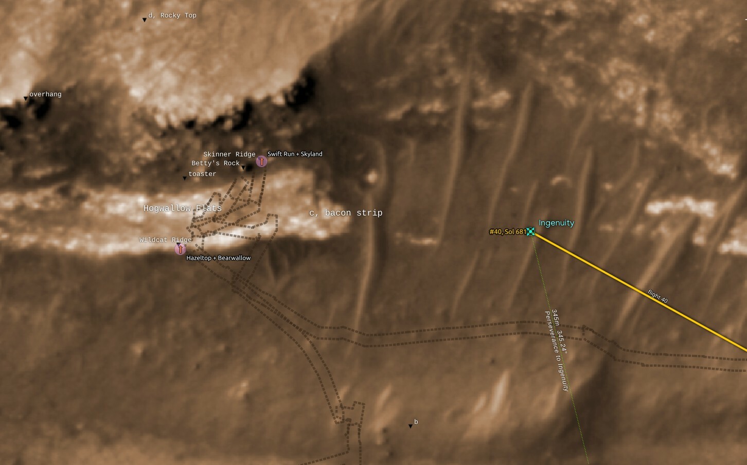
@65dBnoise nice! One thing that surprised me in this and @stim3on 's processing is how traces of the rover's activities over at Rocky Top are nowhere to be seen
2
Share
Share on Mastodon
Share on Twitter
Share on Facebook
Share on Linkedin
65dBnoise

@sharponlooker
@stim3on's is not the same image with this one, but still, I can see tracks near the center left of his image, and that's of an even fainter part of them. But these images were shot looking west and the sun's glare reduces their contrast and makes things worse in both cases.

0
2y
65dBnoise

@sharponlooker @stim3on

Ah, I think I misinterpreted your comment; you 're right, no tracks can be seen under the Rocky Top, despite the heavy activity there.

#NASA better start putting feature names on a public map. Here is a map of that area with my understanding of what name goes where:

#QGIS #HiRISE #Perseverance #Solarocks

{"p":"","h":{"iv":"ROXSYW+cfvEbFHu5","at":"ocxplSQjdRC3tXEtB/9/wg=="}}
1
2y
Replies